THE HEALTHCARE ACCESS DIVIDE: GEOGRAPHIC CONCENTRATION OF UNMET NEED
QGIS / Spatial Analysis • NYC DOHMH • HATA Project
When evaluating urban well-being and institutional infrastructure, access to timely healthcare services is often treated as a standard baseline across metropolitan centers.
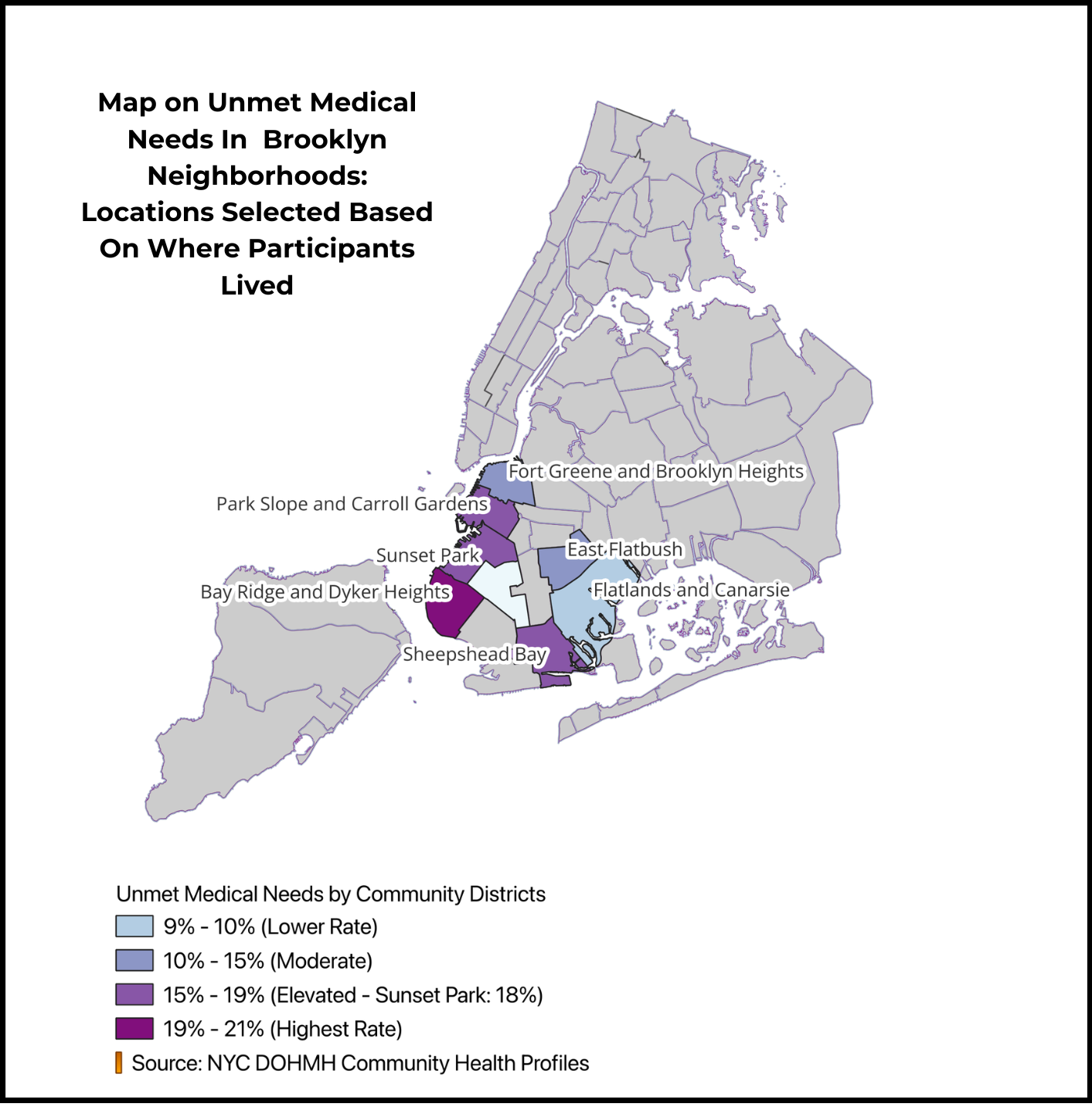
On paper, parts of Brooklyn reflect relatively strong coverage. Neighborhoods like Flatlands and Canarsie anchor the lower end of the spectrum with unmet medical need rates between 9% and 10%, while central and northern corridors such as Fort Greene, Brooklyn Heights, and East Flatbush maintain moderate levels between 10% and 15%.
HOWEVER!
Look at the geographic concentration across South and Southwest Brooklyn where HATA project participants reside. A sharp spatial divide emerges as you move toward the waterfront: Park Slope, Carroll Gardens, and Sheepshead Bay jump to elevated unmet need rates between 15% and 19% (with Sunset Park specifically reaching 18%).
Meanwhile, Bay Ridge and Dyker Heights report the highest severity in the entire dataset (19%–21%), highlighting critical neighborhood-level disparities in care access that disproportionately impact these participant communities.